Understanding CAD in RS: A Comprehensive Overview
In the rapidly evolving landscape of technology and design, Computer-Aided Design, or CAD, has emerged as a pivotal tool in a variety of industries. CAD systems have revolutionized the way professionals approach design, offering unparalleled precision and efficiency. In the context of RS, which stands for Remote Sensing, CAD plays a crucial role in enhancing the accuracy and functionality of spatial data representation. Remote sensing involves the acquisition of information about an object or phenomenon without making physical contact, typically through satellite or aerial imagery. The integration of CAD in remote sensing applications allows for the meticulous planning, analysis, and visualization of spatial data, which is essential for a wide range of applications including urban planning, environmental monitoring, and infrastructure development.
The importance of CAD in RS cannot be overstated, as it bridges the gap between raw data collection and practical application. By leveraging CAD tools, professionals can create detailed models and simulations that facilitate better decision-making processes. These tools enable the transformation of complex data sets into intuitive visual representations, making it easier for stakeholders to interpret and utilize the information effectively. Furthermore, the use of CAD in remote sensing enhances the accuracy of mapping and modeling, reducing the margin for error and increasing the reliability of the data.
As industries continue to embrace digital transformation, the demand for skilled professionals who can harness the power of CAD in remote sensing is on the rise. This demand is driven by the need for precise and efficient data analysis and visualization techniques that can support complex projects and initiatives. Understanding the capabilities and applications of CAD in RS is therefore essential for anyone involved in fields that rely on spatial data. In this article, we will delve deeper into the intricacies of CAD in RS, exploring its applications, benefits, and the future trends that are shaping this dynamic intersection of technology and design.
The Role of CAD in Remote Sensing
Remote sensing technology has transformed the way we observe and analyze the Earth’s surface. By collecting data from satellites or aircraft, remote sensing provides critical insights into environmental conditions, urban development, and natural resource management. Within this context, Computer-Aided Design (CAD) plays a pivotal role by enhancing the interpretation and application of remote sensing data. CAD systems allow for the creation of highly detailed and accurate models, which are essential for effective decision-making and planning.
CAD in RS: Enhancing Precision and Efficiency
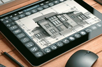
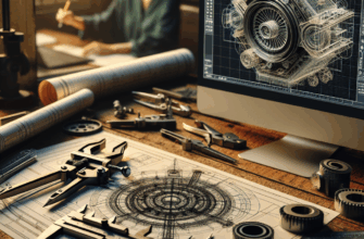
The integration of CAD in remote sensing offers significant advantages in terms of precision and efficiency. CAD software provides tools for drafting, modeling, and visualization, which are crucial for the accurate representation of spatial data. By using CAD, professionals can create precise 2D and 3D models that reflect real-world conditions with high fidelity. This precision is particularly important in applications such as urban planning, where accurate models are needed to assess infrastructure development and land use.
Furthermore, CAD systems streamline the data analysis process, enabling faster and more efficient workflows. Automated features in CAD software reduce the time required to process and interpret remote sensing data, allowing professionals to focus on higher-level analysis and decision-making. This efficiency is vital in industries where time-sensitive decisions are necessary, such as disaster management and environmental monitoring.
Applications of CAD in Remote Sensing
The applications of CAD in remote sensing are diverse and far-reaching. In the field of environmental monitoring, CAD tools are used to model and simulate ecological systems, helping researchers understand the impact of human activities on natural habitats. By integrating CAD with remote sensing data, scientists can visualize changes in land cover, track deforestation, and assess the health of ecosystems over time.
In urban planning, CAD systems are used to design and evaluate infrastructure projects. Remote sensing data provides the foundational information needed to create accurate maps and models, while CAD tools enable planners to visualize proposed developments and assess their potential impact on the surrounding environment. This integration is essential for creating sustainable and resilient urban spaces.
Additionally, CAD in remote sensing is instrumental in the field of agriculture. By analyzing satellite imagery and integrating it with CAD models, farmers can optimize crop management practices, monitor soil health, and improve yield predictions. This application of CAD technology supports precision agriculture, which aims to increase productivity while minimizing environmental impact.
Challenges and Future Trends
While the benefits of CAD in remote sensing are clear, there are also challenges to consider. One of the primary challenges is the need for interoperability between different software systems. As remote sensing and CAD technologies continue to evolve, ensuring compatibility and seamless data exchange between platforms is crucial for maximizing their potential.
Looking to the future, advancements in artificial intelligence and machine learning are expected to further enhance the capabilities of CAD in remote sensing. These technologies have the potential to automate and improve the accuracy of data analysis, leading to more sophisticated models and simulations. Additionally, the increasing availability of high-resolution satellite imagery will provide even more detailed data for CAD applications, opening up new possibilities for innovation and development.
Conclusions
The integration of Computer-Aided Design in remote sensing represents a powerful synergy that enhances the accuracy, efficiency, and applicability of spatial data analysis. By leveraging CAD tools, professionals across various industries can create detailed models and simulations that support informed decision-making and planning. As technology continues to advance, the role of CAD in remote sensing is likely to expand, offering new opportunities for innovation and growth in fields ranging from urban planning to environmental conservation.